
Parcel Details
If you need to display details for a specific parcel, simply find it in the parcel overview and click on its name. Another option is to navigate from the Map.
On the parcel detail page, you can find general information, details about activities performed on the parcel, monitoring of biophysical parameters, and growth potential.
General information about the parcel
The initial section of the parcel details page contains general information. Some of them are pre-determined and cannot be changed, other cas be edited in the app (for example crop, variety, local name, etc.)
Information on the parcel detail page includes:
- local Name,
- Short Code,
- Area,
- Culture,
- Crop,
- Variety,
- Zone,
- NSA,
- Yield grade,
- Application zone,
- Altitude,
- Slope,
- Restrictions.

Fig. 1: Parcel Detail - Overview
Furthermore, on the parcel detail page, you will find a table summarizing the crops and the supply of nitrogen and other elements to the sown crops. This allows you to track how much nitrogen has been applied to the crop. If you apply nitrogen to a future crop, it will be displayed here only when the crop is actually sown.
On the right side, there is a map displaying the geometry of the parcel itself. The map is interactive, and you can switch to the details of other parcels by clicking on the selected parcel on the map.
Activities on the parcel
The Activities tab contains a table with information about fertilization, plant protection spraying, and other activities recorded on the parcel. You can view the details of an activity by clicking on the green activity name.
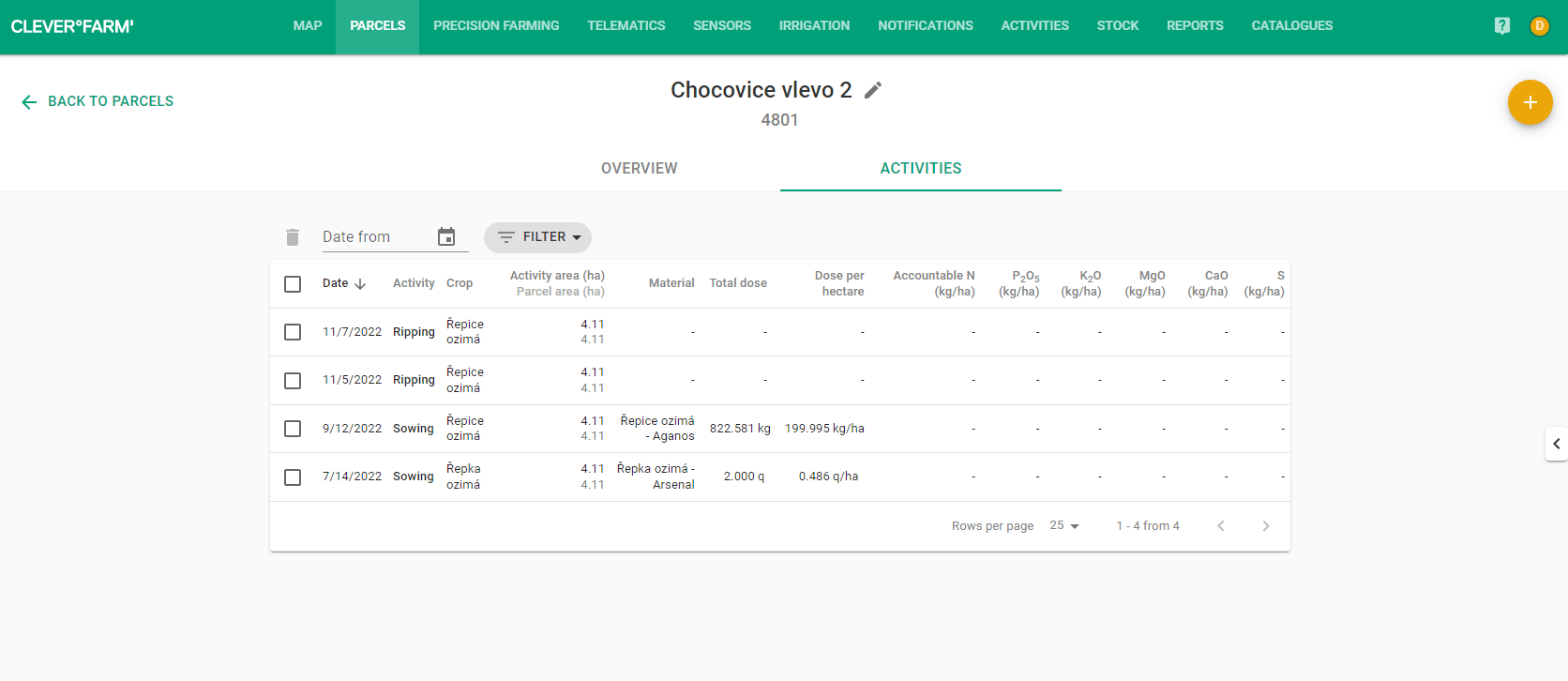
Fig. 2: Parcel details - Activities
You are viewing parcel information and want to record an activity for it? Click on the orange plus button located in the upper right corner. Choose which activity you want to perform on the parcel. You will then be taken to the activity form where the parcel is already selected.