
Introduction to satellite data application
Satellite imagery of the Earth's surface is not new. There are currently three programmes that image the Earth's surface that are useful for agricultural purposes: Landsat 1-7, SPOT and Sentinel 2.
Sentinel 2
The satellites of the European Copernicus programme - Sentinel 2, are primarily designed to monitor land cover and changes in land cover. It carries on board an MSI multispectral sensor, which builds on the legacy of the Landsat and SPOT missions. This sensor is the first of its kind to cover three bands at the red end of the visible spectrum, making its data ideal for vegetation monitoring, with a focus on forest classification, mapping leaf chlorophyll content, monitoring vegetation health, creating vegetation indices or detecting water stress.
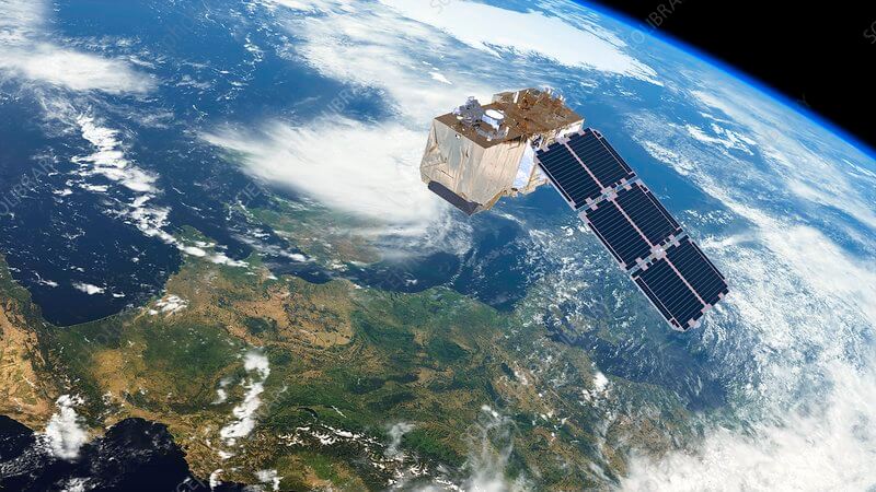
Fig. 1: Sentinel 2 over Europe. Source: ESA/ATG medialab
Sentinel's advantage over Landsat and SPOT is its focus on agriculture, imaging more diverse bands and a wider spectrum in the red. Previously it was possible to get about 3 good images per season, now we have images every 3-4 days.
Due to the high spatial resolution of the images, a parcel as small as 0.5 ha is a meaningful minimum for using satellite data.
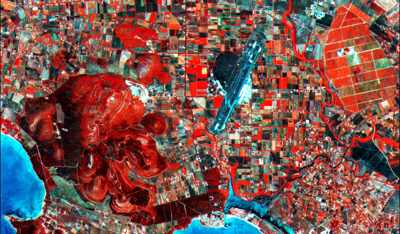
Fig 2: A slice of the first image taken by Sentinel-2A on 27 June 2015 showing the northwestern part of the island of Sardinia. The vegetation here is in different shades of red and in this case, brighter red means healthier vegetation with higher chlorophyll content. Source: Copernicus data (2015)/ESA
Indices calculated from Sentinel 2:
All calculations are possible due to solar reflectance sensing. Sentinel 2 therefore uses 13 bands from the visible (RED) to the mid-infrared (NIR) spectrum. The basic assumption is that a healthier plant has more chlorophyll in it, i.e. more in the NIR than in the RED spectrum. So if the plant is healthy, the NIR will dominate, if something happens to the plant (stress or complete die-off), the RED spectrum will start to dominate and the NIR will noticeably decrease.
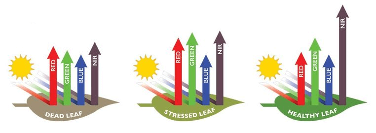
Fig. 3: Reflection of solar radiation from vegetation
NDVI = Normalized Difference Vegetation Index is a calculation strictly between NIR and RED. Its disadvantage is the dependence on the time of day the image was taken, i.e. an image taken in the morning and afternoon may show changes even if there is no change in the vegetation. NDVI was originally developed to detect where vegetation is and is not present, i.e. not to evaluate its condition.
EVI = Enhanced Vegetation Index - the NIR and RED calculation is added with additional wavelengths and thus only corrects for inaccuracies in the NDVI, so it is not dependent on the time of day the image was taken.
LAI = Leaf Area Index, leaf area index of aboveground biomass, stand density.
Where we are going - cooperation with GISAT
Gisat's focus on remote sensing ranges from the distribution of satellite data and geoinformation programs, to the digital processing of satellite or aerial imagery, to the creation of geoinformation systems.
Two years of field data measurement and analysis with instruments for measuring chlorophyll, plant water content and leaf area index (LAI). The measurements were taken across the country on the same plots each time Sentinel was overhead so that they could compare the measurements against the images. Measurements were taken for the following crops: winter wheat, spring barley, winter rape, alfalfa, sugar beet and maize (together about 85% of the arable land in the Czech Republic).
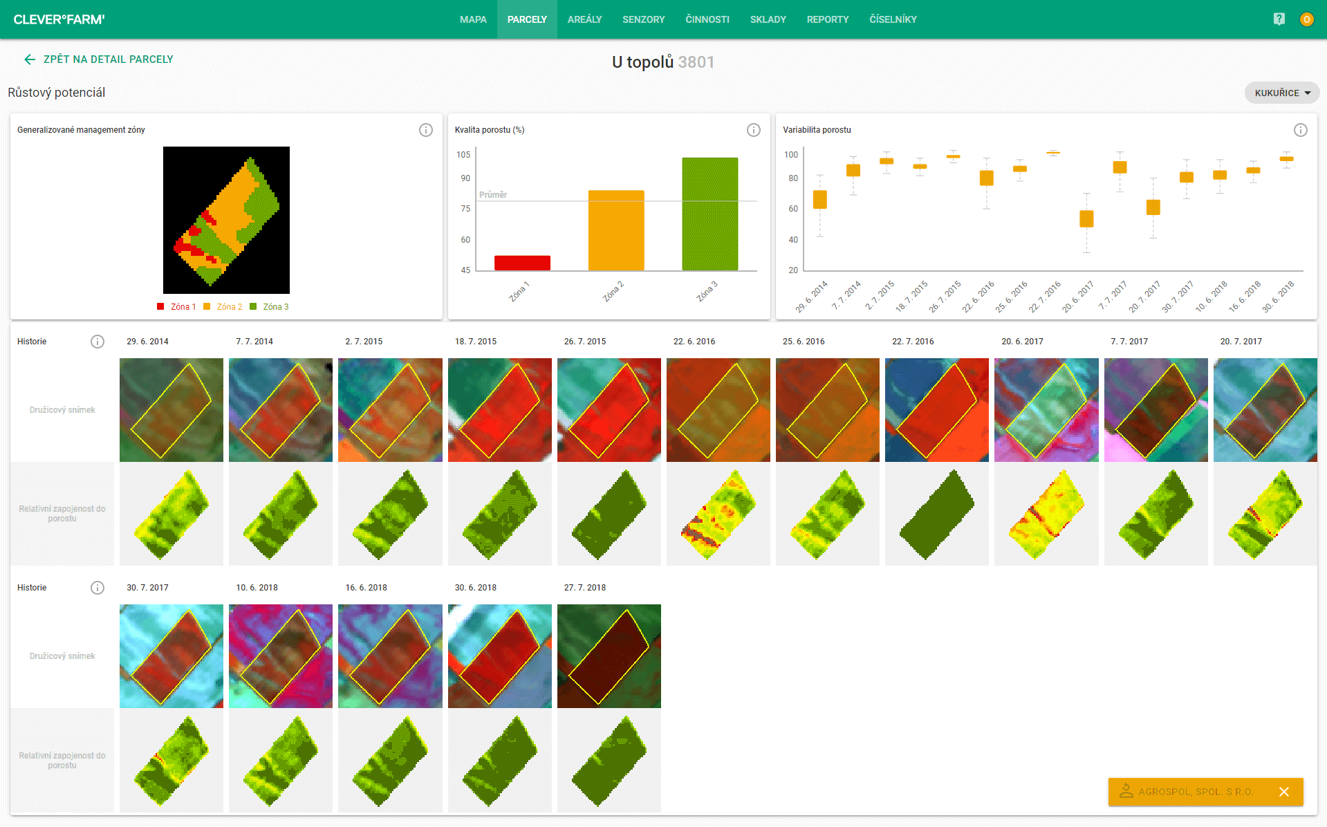
Fig 4: Growth potential of the parcel
By collecting the data and comparing it against Sentinel, a database has been created that allows any future image to be related to the measured data and thus determine the exact value just as if we were in the field. This will allow us to arrive at more accurate results for variable rate fertilisation, for example, than through the use of the EVI index.
In cooperation with Gisat we offer the following services:
- Historical plot variability (stand involvement by crop),
- monitoring of biophysical parameters (chlorophyll content, water content, leaf area index),
- variable seeding and fertilization.